Showing posts with label story. Show all posts

Wednesday, January 4, 2012

Leg 8: HESN - Aswan Intl (Egypt) -> OEJN - King Abdulaziz Intl (Saudi Arabia)

Aswan Intl -> King Abdulaziz Intl
Distance: 556.0 nm
Estimated fuel burn: 64.1 gal / 384.7 lb
Estimated time en route: 3:39

Long flight today as I am about to leave  Egypt and head to  the Arabic Peninsula. First stop is Jeddah  in Saudi Arabia.
After departing Aswan I first headed south towards Abu Simbel to see the  wonderful temple that is in that city, then turned towards East and Red Sea coast. Before reaching the  Red Sea, I overflew Elba National park and admired the interesting  desert  landscape. I even saw something that looked like a meteor or volcanic crater, but couldn't find it's name on the internet. After almost an hour  over the Red Sea I landed a Jeddah, but didn't  get to see to much due to the scenery and texture resolution. Still I was impressed with the size of the city and airport.

Flight map

Aswan dam

Lake  Nasser as  we head towards Abu Simbel

Abu Simbel with the temple

Lake Naser again, after Abu Simbel I climbed to 10000ft for the rest of the route

Desert dunes

Nice mountain landscape


I wonder what kind of crater is this one.


Route map on GNS530 screen


Red Sea coast

Arabian coast

Jeddah city

Saturday, December 31, 2011

Leg 7: HECA - Cairo Intl (Egypt) -> HESN - Aswan Intl (Egypt)

Cairo Intl -> Aswan Intl
Distance: 414.2 nm
Estimated fuel burn: 48.2 gal / 289.3 lb
Estimated time en route: 2:45

I have left Cairo at noon preparing for a long, but interesting flight along the Nile river, flying over some of the Egyptian monuments and historic cities. Probably this was the leg with the most sights along the way. After three hours of flight I landed at Aswan on the shore of Lake Nasser. On the way I overflwe Luxor and the Valley of the kings.


Departing Cairo Intl

Pyramids south of Cairo


A  lot of cities along the Nile


Desert landscapes


Valley of the Kings, and temple of Luxor

Karnak Temple


Sandstorm in the distance

Lake Nasser and the dam at Aswan

Philae

Final at Aswan airport, Lake Nasser on the right

Nice wall of Aswan airport
Addon scenery: Egypt for FSX

Friday, December 30, 2011

Leg 6: LCPH - Paphos Intl (Cyprus) -> HECA - Cairo Intl (Egypt)

Paphos Intl -> Cairo Intl
Distance: 319 nm
Estimated fuel burn: 46.1 gal
Estimated time en route: 2:40


Very beautiful afternoon as we are heading towards Egypt. Quite boring start of the trip, with an hour and a half over water, but soon after that I had the first glimps of the African continent. Port Said was the first city we overflew. It is the starting point of the Suez Chanel, a waterway linking Mediterrana with the Red Sea. I folllowed the channel towards Ishmaila where I turned west towards Cairo. Quite a few ships in the Suez Channel this day.
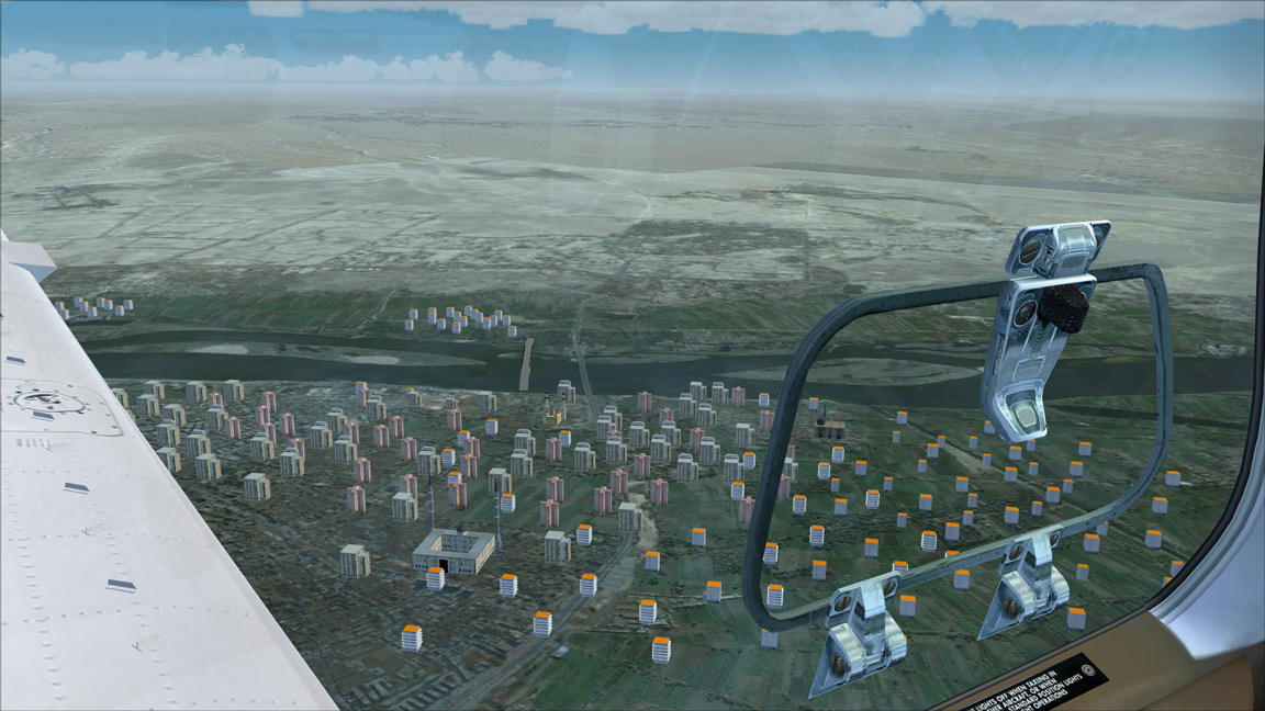
Before landing in Cairo, I took a small detour to admire the pyramids, Sphinx and Cairo city. I didn't expected the city to be that big.
In the next flight I will follow the Nile to the south and hope to spot more of the Egyptian monuments and landscapes.
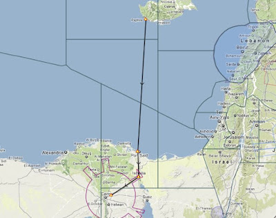
Flight Map
Long leg over the sea

Coast of Africa with Port Said in the distance

Over Port Said


Ships on Suez Chanel

Folowing the Chanel to the south

Ishmail city, time to leave Suez Chanel and turn towards Cairo

Circular cropfields in the desert

Nice  detail city


Old setlement markins in the desert


Cairo city center


The Pyramids


And from the other side while preparing to  land

Cairo tower